Opening Ceremony lays the foundation for cross-sector collaboration and breakthrough solutions.
10-14 JANUARY 2027 Abu Dhabi, UAE
ADSW 2027 SAVE THE DATE
EN
The Zayed Sustainability Prize Awards Ceremony celebrates 11 winners driving real-world impact across the categories of Health, Food, Energy, Water, Climate Action and Global High Schools.
The ADSW Summit sparks dynamic, inclusive discussions that drive the global sustainability agenda forward.
This Global South–focused gathering will convene policymakers, developers, financiers, and off-takers from the Global South and the UAE.
Blue Forum will focus on mobilizing $100 billion in water and ocean investment by 2030.
Read the latest thoughts and analysis on breakthrough solutions driving impact for a sustainable future
Explore reports and strategic insights from ADSW
Line of Sight Podcast brought to you by ADSW
Hear influential voices discuss global challenges and the solutions for a sustainable future
Subscribe to get the latest news, events and announcements
Open to all, the competition will accept submissions until November 16, 2025.
Get insights from crucial conversations throughout the global sustainability calendar
Watch virtual conversations with thought leaders and experts around the world
Find out why we convene the global sustainability community each year
See the sustainability experts helping guide ADSW's strategy
Read our story
Be part of a leading global sustainability platform
See the leaders from across sectors and around the world who have joined ADSW
A global leader in sustainability, Masdar has hosted ADSW since 2008
Three case studies on AI’s growing role in urban planning and mobility

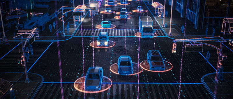
Cities have always been shaped by the technologies of their time. From railways and highways to elevators and smartphones, each major wave of innovation has influenced how cities are designed and how we experience daily life within them. Today, a quieter but no less transformative shift is underway. Artificial intelligence is changing how cities plan, move, and grow by helping city leaders identify problems sooner, test ideas more safely, and design streets that work better for how people actually live.
About 45% of the world’s 8.2 billion people now live in urban areas, with the UN projecting two-thirds of global population growth between now and 2050 to occur in cities. This means urban populations will expand even as population growth slows. With climate pressures also intensifying, city planners are increasingly using AI as a practical tool for decision-making, and across the world, three applications stand out:
1. Testing city decisions before they are built
Traditionally, urban planning has depended on static masterplans and forecasts that struggle to keep pace with rapid change. AI-powered digital twins are allowing planners to use rich, real-time data to simulate future conditions before construction begins. By combining detailed 3D maps with live data on buildings, transport, energy use, and the environment, these models allow AI to spot patterns and quickly test scenarios: How does higher density affect traffic? How do new buildings alter wind or heat? How does redesigning a street change pedestrian movement?
One of the most cited examples is Virtual Singapore, the country’s national digital twin. Planners use it to simulate everything from transport demand to microclimate impacts across the city. Instead of relying on assumptions, they can see how a decision, before it’s committed to, ripples across entire systems.
Dubai Live, the municipality’s digital twin, provides a unified, live overview of mobility flows across the city. Because data is centralized across domains, planners and transport authorities can see how changes in one system, like major events, roadworks, or emergencies, affect traffic and mobility, enabling proactive coordination of services across departments.
For mobility, this has a huge impact. When cities can simulate future travel demand alongside land-use changes, they can plan transit, walking, and cycling infrastructure more accurately, avoiding congestion problems before they appear and saving public money in the process.
2. Making traffic signals and streets smarter in real time
One of the most immediate ways people experience AI in cities is through traffic flow. Many urban traffic systems still rely on fixed schedules that change by time of day, regardless of what is actually happening on the street. But AI-enabled traffic management systems are far more responsive, using real-time data from sensors and cameras to adjust traffic signals dynamically.
In Pittsburgh, the old preset plan may soon be gone in favor of signals that adapt to changing demand. SURTRAC, an AI-driven system developed by Carnegie Mellon University, has been tested on city streets, coordinating traffic signals in real time and responding to conditions as they unfold, to reduce delays, smooth traffic, and give priority to buses, emergency vehicles, cyclists, and pedestrians. Studies have shown meaningful reductions in travel time, vehicle stops, and emissions.
Transport for London has also trialed AI, using sensors to better understand how people, especially cyclists, move through the city. It made planners able to design safer streets and more effective signal timing.
The real power of these systems is in the data they generate, which helps planners identify which intersections need redesign, where bus priority delivers the most benefit, and how street space can be rebalanced more fairly among users.
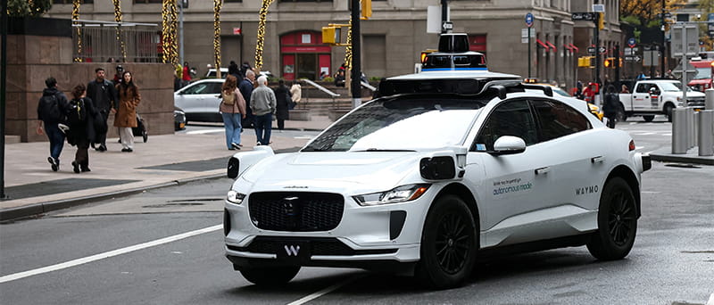
Waymo autonomous vehicle in San Francisco
3. Moving from experimentation to everyday mobility
Once treated as a distant promise, autonomous vehicles have been pushed onto real city streets by recent advances in AI, especially in machine learning, computer vision, and sensor fusion. Cities in the United States, China, and Europe have begun deploying autonomous shuttles and robotaxis in defined zones, moving beyond small pilots toward everyday mobility services. What’s changing is not just the technology, but the willingness of cities to integrate autonomy into real transport networks.
In the United States, San Francisco and Phoenix have seen the rollout of fully autonomous, AI-powered robotaxi services operated by Waymo. Passengers hail rides through a standard mobile app and travel without a human driver. Using AI to process real-time data from cameras, lidar, and radar, the vehicles navigate complex urban environments, including busy intersections, cyclists, pedestrians, and changing traffic conditions. These new commercial services mark a clear shift from experimentation and trial to day-to-day, on-demand urban mobility.
A quieter revolution in city-making
Despite the hype surrounding artificial intelligence, its contribution to cities is relatively unglamorous. In this case, the functions of planners, traffic engineers, and designers aren’t being automated by AI. Instead, their ability to build better cities is being drastically improved by faster feedback on works and clearer sightlines into complex urban systems.
As cities everywhere confront growth, climate change, and inequality, AI is becoming less about the future and more about the present. The cities seeing the greatest benefits are embedding AI into everyday planning and mobility decisions to connect long-term vision with real-world operations, and building cities that move better, feel safer, and plan smarter.
Find more insights in the report from Abu Dhabi Sustainability Week’s Advisory Committee on Smart Cities and Mobility: link
More Articles
19 DECEMBER 2025
Energy
5 Ways Supply-Chain Circularity Is Making Countries More Climate-Resilient
18 DECEMBER 2025
Sustainability
Abu Dhabi Sustainability Week 2026 to Rally Global Leaders Around the Future of Energy, Water, Climate and Finance
27 NOVEMBER 2025
Energy